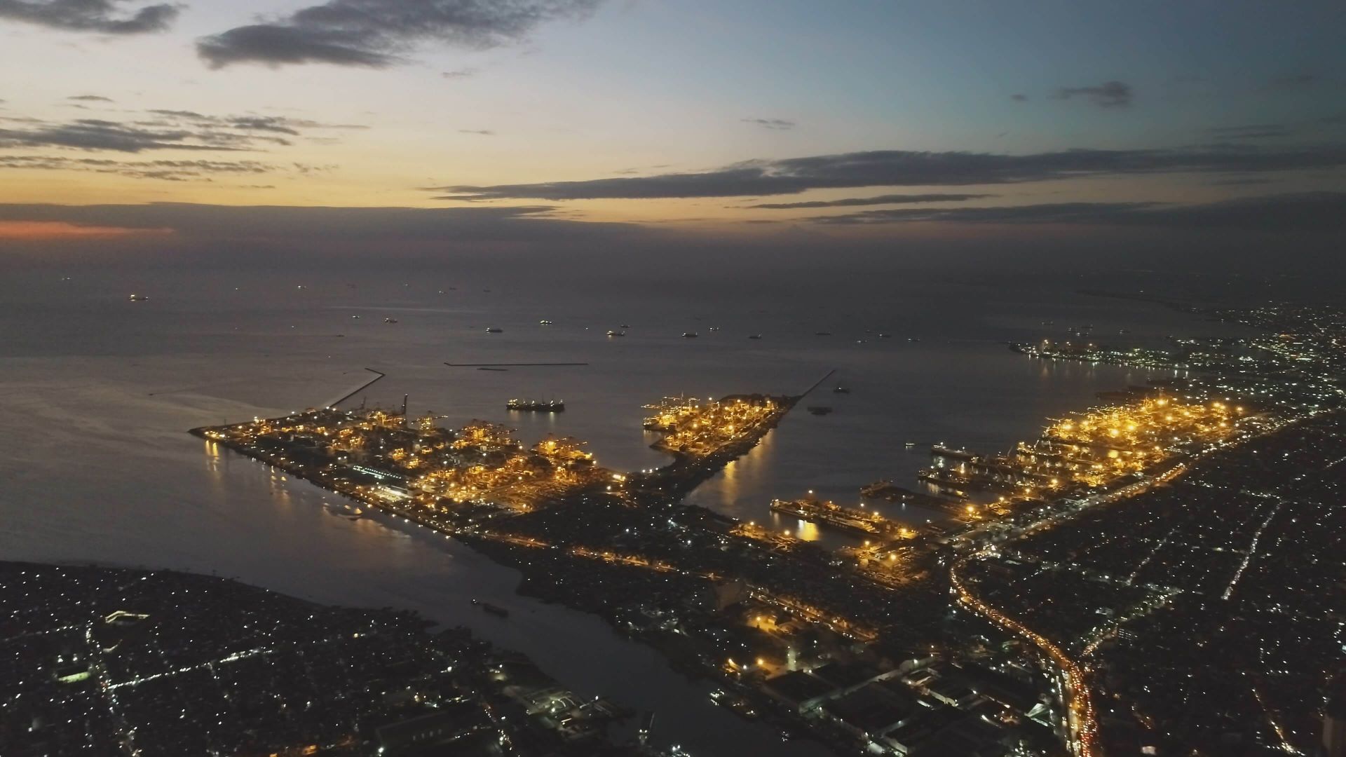
The Philippines has long been a business and tourist destination, with each city, region, and island offering its finest. However, one of the most significant structural barriers is our archipelagic terrain. A landscape created boulders for other cities to develop at the same rate as the capital region and metro cities.
Bridge Support
The Department of Public Works and Highways (DPWH) is at the receiving end of these problems. Still, now, they are well-funded and supported to build better and more solutions. The Marcos Jr. administration introduced its “Build, Better, More” infrastructure plan, which aims to continue and improve former President Duterte’s “Build, Build, Build” program.
This commitment intertwines with the socioeconomic priorities of the administration. For example, a significant budget is allocated to farm-to-mill roads and farm-to-market networks to bolster food security and create food accessibility. Access roads to irrigation and farming areas are also subsidized to contribute to the same goals. One of the projects under this is the Samal Island-Davao City Bridge worth PHP 23.04 billion, which extends to 3.98 kilometers, is toll-free and can serve around 25,000 vehicles daily.
Another priority is community resilience against natural disasters and disease. 16 evacuation centers were completed from July to September, with an additional 64 targeted for completion next year. COVID-19 isolation facilities and modular hospitals were also made more accessible to address the ongoing health risks. Moreover, over 2,933 old structures, such as bridges, schools, and others of the exact nature, were assessed to comply with safe occupancy standards.
And of course, economic development — urgently, recovery — is a top priority. The transportation industry is one of the most common costs associated with the elements of economic development. A longer travel time for employees is an economic and opportunity cost limiting productivity. A delay from one region to another due to congestion increases the cost of goods and services. Inefficient or even non-existent routes limit the number of supplies transported and, thus, can create scarcity. Even absent these harms, good transportation essentially is good for tourism and increases the average Filipino’s quality of life.
DPWH Secretary Manuel Bonoan highlights how improved roads and transportation are a common good by explaining:
“What we are trying to do is to encourage the development of more highways or expressways going in and out of (Metro) Manila… to disperse the economic development outside of Metro Manila.”
Thus, one of the biggest projects to make this statement of hope a reality is the Bataan-Cavite Bridge Project.
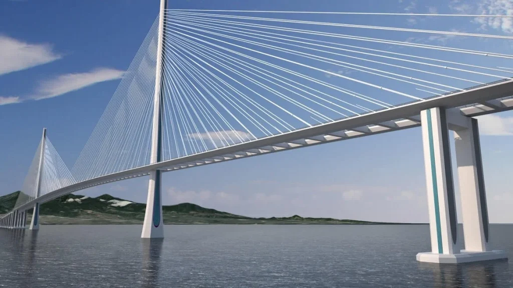
Bataan-Cavite Bridge Render
Photo from tylin.com
Linking the People’s Hope with Development
A multi-billion peso bridge is about to be the new view over Manila Bay. Not only is it a 32.15-kilometer site, but it is also believed to bring “massive” economic growth opportunities to Luzon and the country.
Currently, the DPWH is rushing to complete the design works of the bridge, a clear alignment with the Marcos presidency commitments. The bridge is expected to connect Region 3 and Region 4-A to the National Capital Region (NCR).
More than the striking length of the bridge and the ambitious timeline, this project will effectively connect the “Rice Granary of the Philippines” and the “Industrial Powerhouse of the Philippines” with the country’s political, economic, and educational center. This opens massive opportunities for the average Filipino who is heavily reliant on farming, manufacturing, and servicing — the top lucrative industries in the country.
The bridge will also allow industries to easily travel outside of the metro area towards a marine viaduct highway. This will lead to another set of opportunities in business expansion which will more likely trickle down to more employment, economic activity, and purchasing capacity.
Behind the Bridge
The idea to increase interconnectivity among the areas that the interlink covers is not unique. Actually, it was in 1987 when the then-representative Felicito Payumo proposed a bridge to lock the lands surrounding Manila Bay.
The proposed bridge mimics the Tokyo Bay Aqua-Line. Hence, in the early 200s, at least two Japanese firms, Itochu Corp. and NKK had already conducted feasibility studies. Unfortunately, plans were not built into anything concrete until the year 2016, when Payumo proposed again. Another onsite study was conducted by the China State Construction Engineering Corporation (CSCEC) in 2017, visiting the coastal towns in Bataan.
At last, in 2020, The National Economic and Development Authority (NEDA) approved the project with the budget it has today, PHP 175.7 billion, spanning over 6 years of implementation.
During the World Economic Forum (WEF) on the Association of Southeast Asian Nations (ASEAN), then-President Duterte presented his administration’s 0-10-point socioeconomic agenda. One of the main points is to accelerate infrastructure spending to 5% of the Philippines’ gross domestic product with the aid of the Public-Private-Partnership (PPP) agenda.
Rightfully so, infrastructure and transportation should be one of the biggest recipients of government funding as the ADB outlines that underdeveloped public infrastructure in the country will impede the potential of business and economic opportunities. These benefits, though, need to be weighed against the costs, especially environmental and social ones. Government agencies are looking into the environmental criteria to evaluate the project on its encroachment in critical environmental areas, soil erosion, threat to species, and waste generation from construction. Social criteria include possible displacement, resettlement impact, and right-of-way conflicts.
Designing, Financing, and Inspecting
As of September 2022, marine geophysical surveys and geotechnical investigations are already being conducted to ensure the bridge is feasible and sustainable. This part of the plan is already 55% accomplished.
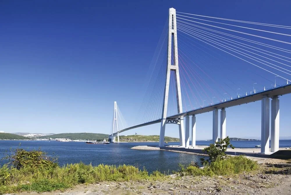
Cable-Stayed Bridge
Photo from structuremag.org
The bridge includes the construction of two cable-stayed navigation bridges, the North Channel Bridge and the South Channel Bridge. Land viaducts, marine bridges, and ancillary buildings will also be constructed under the project. As mentioned, it will cross over Manila Bay which is bound by Cavite and Metro Manila on the east, Bulacan, and Pampanga on the north, and Bataan on the northwest. With the four-lane bridge stretching 17km between Cavite and Corregidor and 4km between Bataan and Corregidor, it will become the longest bridge in the country. The posts of the bridge will also be near a stopover from high-speed public trains for easy access for commuters.
The entire project will cost around PHP 175.7 billion. To finance a monumental project, the Asian Development Bank (ADB) approved a $200 million loan for the infrastructure preparation and innovation facility last December 2019. They are also currently preparing to support the construction of the project this year.
Ensuring that the project meets its targets, a joint venture of the US-based T.Y. Lin International and the Republic of Korea’s Pyunghwa Engineering Consultants, along with the Philippines’ DCCD Engineering Corporation and Switzerland-based Renardet, received the contract for the project. The collaboration for this started in October 2020, when DPWH signed a $59m deal for the detailed engineering design. Moreover, Ove Arup & Partners Hong Kong is a consultant for DPWH for this project. Arup officially commissioned the Maritime Academy of Asia and the Pacific (MAAP) for the design, development, and execution of the critical simulation exercises to record and understand the maneuverability of simulated vessels along the proposed navigation channel beneath the bridge.
The inspections for the bridge are crucial to its success as the bridge needs to be high enough for large marina vessels to pass under Manila Bay since the area will remain a major shipping route to and from the Port of Manila. This consideration is on top of how to sustain the weight of thousands of vehicles over sustained lengths.
Because the goals of the project are astronomical, time is one of the most important investments, but DPWH Senior Undersecretary Emil K. Sadain exclaims:
“Although this project still has a long way to go, the huge progress that DPWH and team of DED Consultants have been making recently is a manifestation of the government’s commitment to fast-track its implementation.”
Therefore, we should be expecting more milestones to be accomplished within the next year, fast-tracking us into the future of transportation and economic development.
Building Better and Building More Opportunities
While the idea has been proposed since the 1980s, it was only recently that it was prioritized due to the urgency of the concerns that it addresses.
For example, the Northern Luzon Express Way (NLEX) has only more recently experienced traffic congestion. To mitigate the problem, around PHP 7 billion has been spent trying to make improvements on technical issues or making motor lanes, to name a few examples. But, this does not solve the root cause of the congestion, which is the lack of alternative routes that other commuters can use. Moreover, even if this was only one of the critical causes of congestion, the Philippine economy urgently needs a boost. Relying on international monetary sources is insufficient. Thus, there is a need to look inward and make improvements to maximize the country’s resources.
For this project to be approved is a sign that it carries multiple benefits directly to the affected regions, adjacent to the connecting areas, and nationwide as everyone benefits economically.
Benefits to Region 3 and Region 4-A
The majority of the land in Cavite is designated for agricultural and fishery activities, with these composing the major income sources for the residents. If the residents want to travel to Central Luzon, they would have to pass by Metro Manila which takes them 4 to 5 hours on average in transit to complete.
This long travel time poses opportunity costs for the average person, businesses, and government agencies. People cannot feasibly sustain commuting to economic hubs located in Metro Manila with the long commute. Therefore, they are forced to apply only for jobs that are more geographically accessible. Vehicle costs for businesses also disincentivize them to expand throughout regions. At face value, this may seem like a problem only for companies. However, if they are incapable of expanding to other regions, this actually harms the number and quality of opportunities that job-seekers can access. The bridge connecting the agricultural and industrial centers of the country incentivizes more competition, expansion, and manufacturing activity overall which allows people who do choose to stay in Regions 3 and 4-A to benefit without having to migrate.
While agriculture and industrial activities are the main livelihoods in these regions, it does not mean other industries cannot be revitalized. If people can commute outside of the city for only 40 minutes, the tourism industry outside of the NCR is augmented. Corregidor Island is famous for its historical sites dating back to the world wards such as the Pacific War Memorial Museum, the Filipino Heroes Memorial, and the Malinta Tunnel. It is even dubbed “the Rock” due to the fortifications found in the area built in World War II. On top of the history, people from the city are fond of nature activities to take a break from city life. The demand is clearly there and ready to act once structural barriers are removed.
Benefits to Metro Manila
Currently, Metro Manila’s traffic is not only caused by residents within the area but also those who need its passage to access other regions. Easing traffic congestion is essential to cut costs in trying to expand roads or impose traffic regulations without a sustainable solution. Therefore, the residents of Metro Manila can benefit through time savings and utilizing infrastructure budgets more effectively.
More personally, real estate prices are also affected by the project, providing citizens with more options in quantity and price point. Due to the reduced travel time, developers are more inclined to urbanize Regions 3 and 4-A, given the number of car users in the area. Even if residents choose to stay, the competition and lack of congestion can benefit them by decreasing property prices. This initiative can already be seen through the investments made by Crown Asia Properties, a leading real estate developer.
Nationwide Benefits
In the end, this project was not approved to benefit only a few regions. It was approved and is currently heavily supported because of its promise to boost the economy. Apart from the benefits listed above, international opportunities are also tapped by the project. Cavite and Bataan are sea gateways into the country, and the interconnectivity of the project allows businesses to turn it into a premier international shipping gateway. This is a major improvement for the Philippines to strengthen our exports and sustainably create demand for the local economy.
Overall, the Bataan-Cavite interlink bridge is one of the most multi-faceted solutions to the country’s problems, hopefully trickling the billion-peso investment back into the Filipinos.
Read more: How Will the Build, Build, Build Projects Affect Your Real Estate Investments?